Radar interferometryczny IBIS-L/S
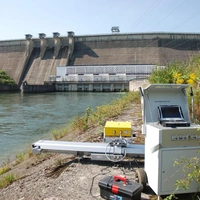
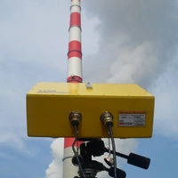
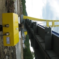
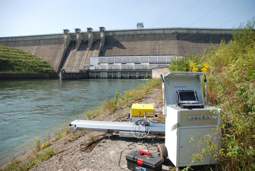
Naziemny radar interferometryczny IBIS-L/S to precyzyjne mikrofalowe urządzenie pomiarowe, służące do zdalnego, bezdotykowego pomiaru przemieszczeń i deformacji obiektów budowlanych oraz powierzchni terenu z wysoką dokładnością. Głównym elementem systemu jest pracujący w dozwolonym paśmie Ku (17,1-17,3 GHz) radar, wykorzystujący technikę syntetycznej apertury (SAR). Radar emituje w kierunku badanego obiektu spójną wiązkę promieniowania elektromagnetycznego o niewielkiej mocy i skokowo zmiennej częstotliwości (modulacja SFCW), a następnie odbiera, rejestruje i analizuje odbity sygnał. Układ interferometryczny precyzyjnie wyznacza zmiany fazy sygnału odbitego względem sygnału nadawanego, pozwalając na pomiar przemieszczeń wybranych części lub obszarów (pikseli) badanego obiektu z dokładnością 0,1 mm. Rozróżnialność pikseli jest osiągana przy zmianie odległości o 0,5 m i azymutu o 0,25°. W skład systemu wchodzi specjalistyczne, dedykowane oprogramowanie, pozwalające na sterowanie procesem pomiarowym, archiwizację i wstępną analizę wyników w czasie rzeczywistym, a następnie ich pełną analizę w fazie post-processingu. Wyniki poszczególnych etapów opracowania mogą być prezentowane graficznie, rejestrowane i eksportowane do otwartych formatów plików.
Formalne warunki udostępnienia należy uzgodnić z Dziekanem Wydziału Geodezji Górniczej i Inżynierii Środowiska. Praktycznie, ze względu na unikatowość sprzętu, jego używanie wymaga przeszkolenia przeprowadzonego przez producenta albo udziału osoby ze znajomością obsługi urządzenia.
-Detekcja oraz monitoring deformacji terenu i przemieszczeń budowli, z dokładnością 0,1 mm, nieosiągalną dla innych geodezyjnych metod pomiarowych. .
-Modelowanie deformacji zapór wodnych. Równoczesne obserwacje termowizyjne umożliwiają rozdzielenie deformacji termicznych od rzeczywistych deformacji geometrycznych.
-Modelowanie i analiza deformacji budowli inżynierskich.
Dokładność pomiaru przemieszczenia wynosi 0,1 mm. System IBIS ma 2 wersje:
- IBIS-L–radar dalekiego zasięgu (do 4 km) o rozróżnialności dwuwymiarowej (0,5 m w odległości i 0,25° w azymucie), służy do wyznaczania przemieszczeń obiektów powierzchniowych (np. osuwisk, zapór).
- IBIS-S–radar o zasięgu do 1 km i częstotliwości próbkowania do 200 Hz, służy do pomiaru i analizy przemieszczeń oraz szybkozmiennych drgań konstrukcji.
Jednostka odpowiedzialna
Grupa / laboratorium / zespół
Zespół Badawczy Technologii Informatycznych w Inżynierii Lądowej